Subject: ACC000034n
Comments
-
 by
Jeshyr
by
Jeshyr
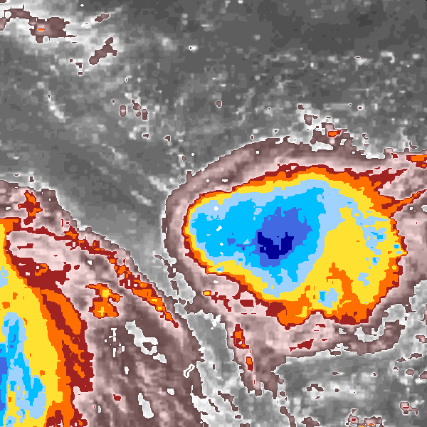
Found this one really hard - it seemed to alternate between #curvedband and #embeddedcentre every second picture!
Posted
-
by
Struck
moderator, translator
Yes I agree with you. Maybe it could be a #shear-storm, too, because of the colours, which are closed together.
Posted
-
by
HurricaneTracker
moderator
I would go with #embedded-center based on the central location of the darkest blue (coldest clouds).
Posted
-
by
cch001
scientist
Shear storm is possible but impossible to diagnose just by looking at this image. No low-level (warm) swirls in the clouds visible.
Posted
-
by
Jeshyr
ccho0: can you tell me more what you mean about shear storms relevant to this image? Pretty much my entire storm knowledge is from here!
Posted
-
by
cch001
scientist
I'm looking for "swirls" in the low clouds (grey or pink colored). Wind shear will usually push the cold clouds away to expose the swirls
Posted
-
by
cch001
scientist
Struck mentioned how the colors are close together on the north side - this is sometimes an indication of wind shear (from the north) too.
Posted
-
by
vuchaser
You can kinda see a rounded wedge shape from NW to SE across this storm. It is being negatively affected by outflow wind shear from ...
Posted
-
by
vuchaser
Stronger Tropical Cyclone to the SW. Very close indeed...wondering if this guy sheared out and spiraled into the stronger storm.
Posted